Turf zone – GroovyFarm
Bonnyrigg, in the shire of Midlothian, once a small mining village with a solitary public house (now closed due to Covid-19), a lone hand-operated petrol pump (now long gone) and old men sitting on a bench chatting the day away (now different old men, but still there). Today, an ever-expanding modern commuter town for the big city lights of Edinburgh.
Once green fields with black and white cows plodding steadily to the milking shed twice a day, now new housing estates for family’s with 2.4 children, small dogs with squashed faces and breathing problems, and pointlessly large SUV’s parked in the driveway because the garages are too small to accommodate them. But what the heck, it’s not too bad a place. Plenty of useful cycle ways, footpaths, hidden alleyways and Turf zones a-plenty for the turfer to take, lose and repeat. But enough of that, on with the tour.
With Bonnyrigg located so close to Eskbank and Lasswade, it’s quite difficult to determine in which village the zones actually belong but I’ve made an educated selection and have decided, for right or wrong, that Bonnyrigg has 31 zones. On our turf tour of Bonnyrigg I’m going to take you with me on a merry jaunt to each in turn, following my preferred route, taken in a roughly clockwise direction. This is a long page, so grab a coffee before you read any further.
Turf zone – BurnbraePoint
Our first zone is Pittendreich, mainly because it’s within slingshot range of the front door of my house. In fact, I can freewheel all the way from the driveway, across the street, along the footpath and down to the Pittendreich Burn, from whence the zone takes its name. The zone itself is on a small footbridge across the burn. Our next zone is Brixwold, a few minutes’ pedal or kick scoot upstream. The zone is also a small footbridge across the Pittendreich Burn. Not much to see here but the keen botanist might spot some Impatiens glandulifera, otherwise known as Himalayan balsam, a highly invasive plant that grows rapidly and spreads quickly, smothering other vegetation as it goes. Smells nice when in flower though!
Now we take a short excursion out of Bonnyrigg for zone KirkCockpen, one of my own suggestions, and situated at Cockpen & Carrington Parish Church, just a few minutes from the edge of town. A great spot for the Ghost Minute medal. Easy to reach but dark and spooky at night.
Turf zone – KirkCockpen
Our next zone is back along the often busy B704 to the Sherwood estate. And that gives us a hint to the name of this zone, LadyMarion. Located in a small open grassed area beside a play park, LadyMarion is easy to reach from Sherwood Avenue but I prefer the footpaths that swing around the houses as they are smoother than the streets.
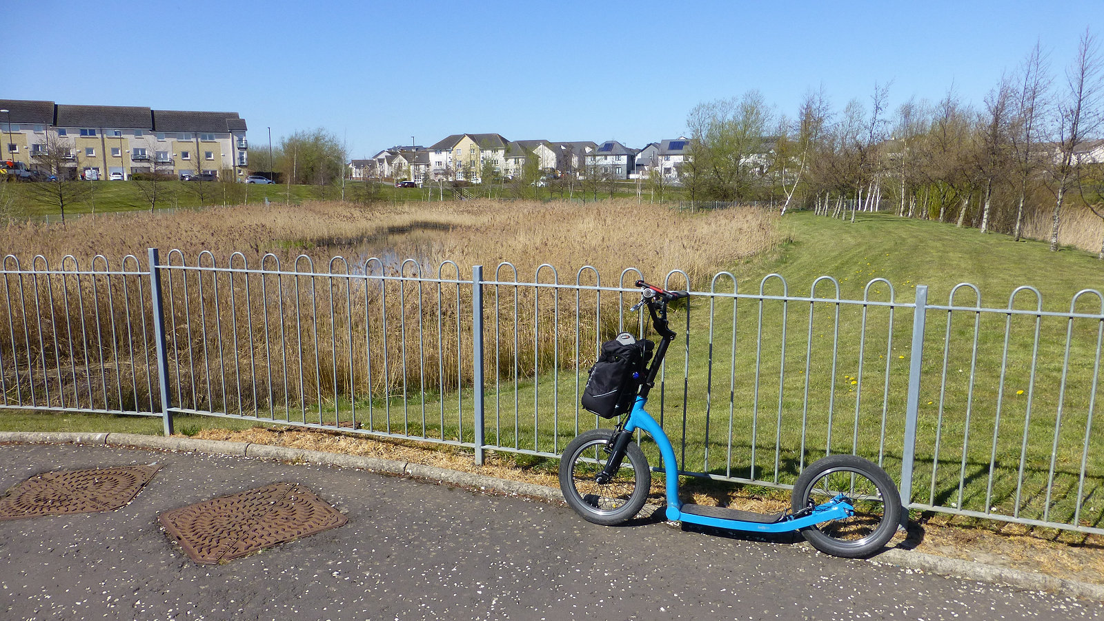
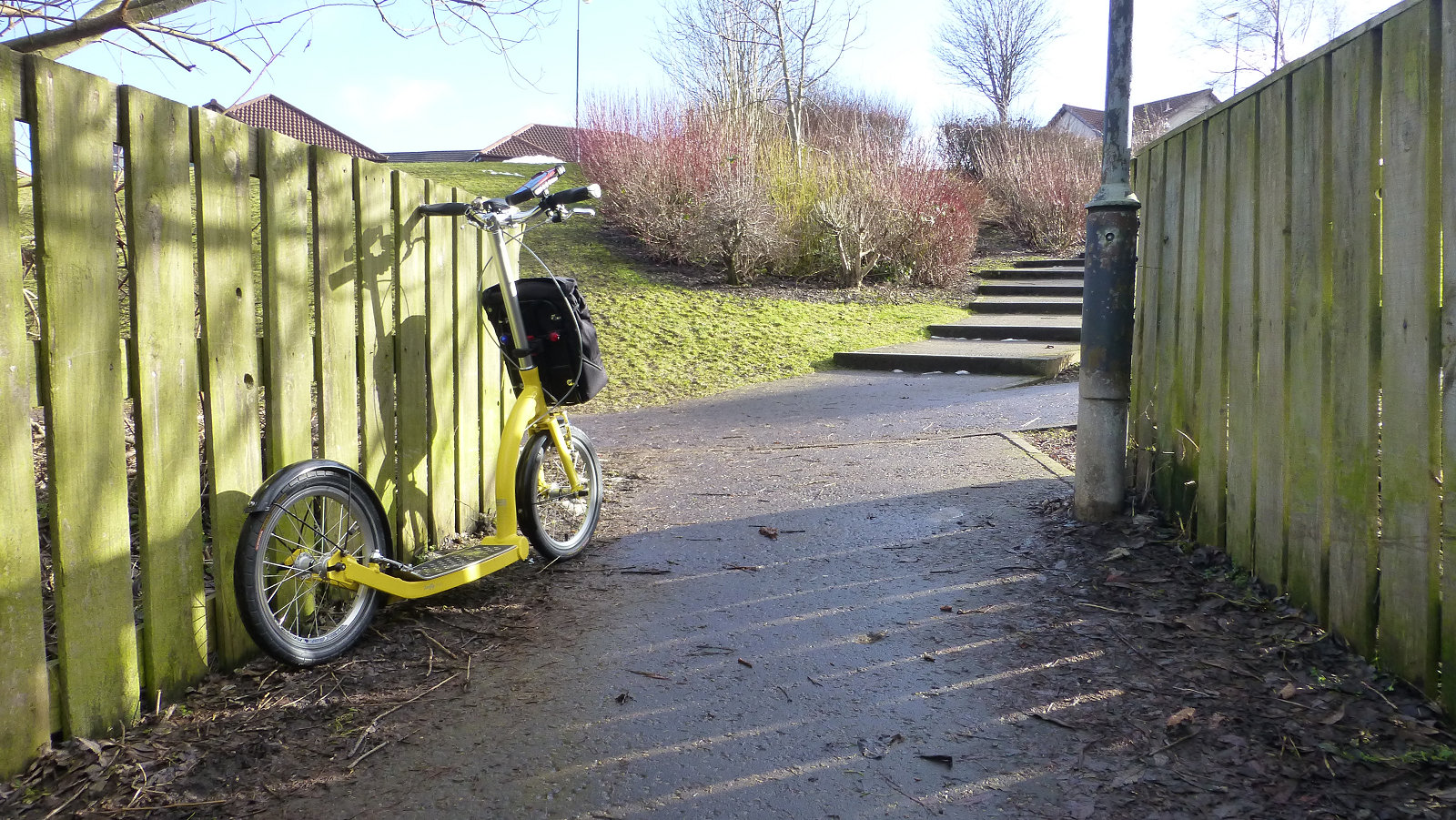
We now drop downhill again and head for our next zone, GroovyFarm. I like stopping at zone GroovyFarm – the name taken from the street to the south, Grove Farm Gardens – it’s located beside a couple of SUDS ponds and there’s always some wildlife going about their business. Coot, moorhen, mallard, mute swan, little grebe, reed warbler, and a host of other LBJ’s* I’ve not been able to identify, at least not yet. There’s also usually a moggy lurking in the reeds somewhere chancing its luck for some dinner. SUDS stands for Sustainable drainage system and they are used to manage surface water, and also provide an environment for wildlife. Thumbs up for SUDS ponds.
Turf zone – Brixwold
ChesterGarden zone is next, and we’re back following the Pittendreich Burn upstream again, and upstream means a bit of a climb, not too bad usually but a bugger when there’s a strong westerly headwind hurtling across the estate. The houses seem to funnel the wind here making it even stronger, granny-gear stuff. The zone name comes from the adjacent street, South Chester’s Garden.
To reach our next zone, BurnbraePoint, we continue our ascent upwards, taking the next footpath on the left. But before you head down towards the zone, take a look to your right, you will need to go up the grassy mound to see. This area was once Polton Colliery and the pit head was where the SUDS pond is now located. Much of the grassy area before you was all part of the colliery, slag heaps and the like, and ground contamination is probably why there are no houses built here. BurnbraePoint is a nice little landscapes area and the best option for taking the zone is inside the fence. I’ve tried all four corners outside the fence and taken the zone at all four but it’s a bit hit and miss. Inside always seems to work just fine.
Turf zone – CockpenBypass
To reach zone Bannockrigg, the quickest way is along to Burnbrae Terrace and into what appears an area of wasteland via the concrete barriers. This area is designated for light industrial development but at the moment is good for wildlife, especially hunting tawny owls at night. It also a good place to stop and view the stars on a clear night. It’s just far enough away from street lights that glare is reduced and planets such as Mars, passing satellites, visiting UFO’s and wishful shooting stars, are more obvious. From Bannockrigg, head round to your right on the path, cross at the crossing and along the shared cycle path, turn right at the burn and you’ve got the next zone, AuldCoal, under your feet. No prizes for guessing how the zone name came about.
The Dalkeith to Penicuik cycleway gives us the next two zones on our tour, Skeltiemuir and CockpenBypass. The cycleway, once the Hardengreen and Peebles branch of the north British Railway, can be busy with cyclists, dog walkers, runners and the like, and I tend to avoid it during the busy times, particularly on holiday weekends in summer. With these two easy zones taken, we now head across to the Polton area of Bonnyrigg. Here we have three zones, Poltonhall, Flash and the very grand sounding ArgylePlaza.
Turf zone – DobbysSock
The cycleway is well linked to streets on either side and zone Poltonhall is easy enough to reach. Its located beside playing fields and these past few months I’ve been amazed just how often sports are being played here. Good to see folks, of all ages, out getting exercise rather than sitting in from of a computer. Just like I’m doing just now. Flash is an easy climb but watch for broken glass on the footpaths, as I’ve seen a lot of the stuff at times. Flash takes its name from the nearby Gordon Avenue, I think. Or perhaps from the song by Queen, or even that advert for the washing powder. Flash cleans floor fast without scratching, if I recall correctly. Yes, it’s a bit sad I know that! Zone ArgylePlaza is an easy take and not very grand at all, except when the dwarf daffodils are in bloom. Not much history in this area other than to say it was once all green fields.
Now, onwards with the tour, or rather downwards to the school, for zones FreeKick and CatSchool. Shortest route to FreeKick – along Polton Avenue Road, left at chip shop, follow path straight down and across the grassy area. You have now reached your destination. CatSchool is next, a fast straight run past the school.
Turf zone – Bonnyrigg
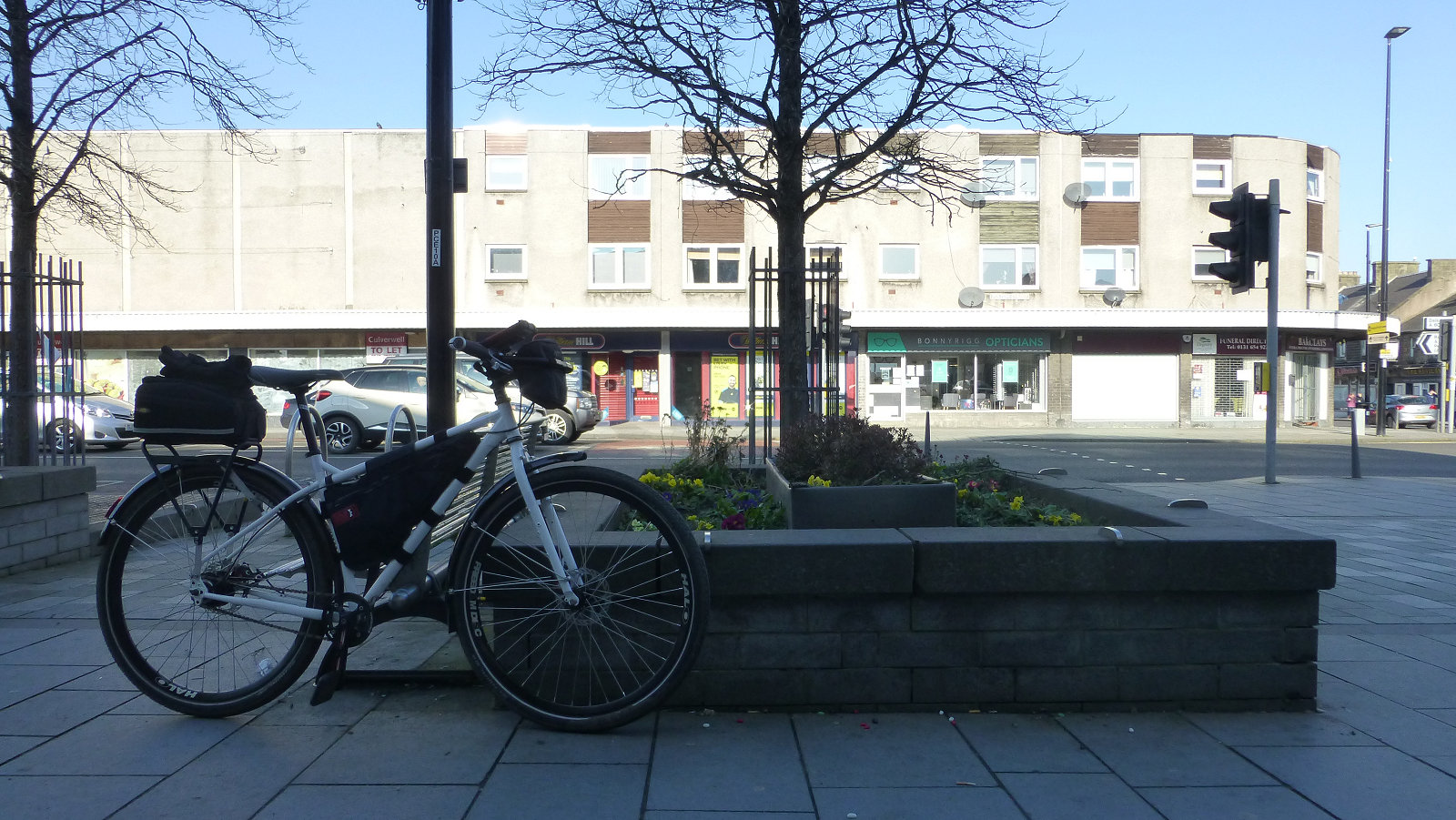
For RobinAndTuck, we head back to Sherwood forest, sorry, housing estate. From CatSchool, head towards the traffic lights, go right then next left and straight on to re-join the cycleway. Then we have a fast downhill and right turn for RobinAndTuck. I’ve often seen broken glass scattered about here to be warned. The next zone on the list is Bonnyrigg, located in the town centre outside the chippy, so perfect if you need some calories. I would recommend the breaded fish supper, with salt and tomato sauce. Yummy!
Next stop on our turf tour of Bonnyrigg is a zone that remembers those who made the ultimate sacrifice in times of war, in this instance both the First and Second World Wars, zone GeorgeWarMem, located in King George’s Park. So, next time you are passing stop and spare a few thoughts for those gave their lives so that we can be free to play games like Turf. Kind of makes you think, doesn’t it?
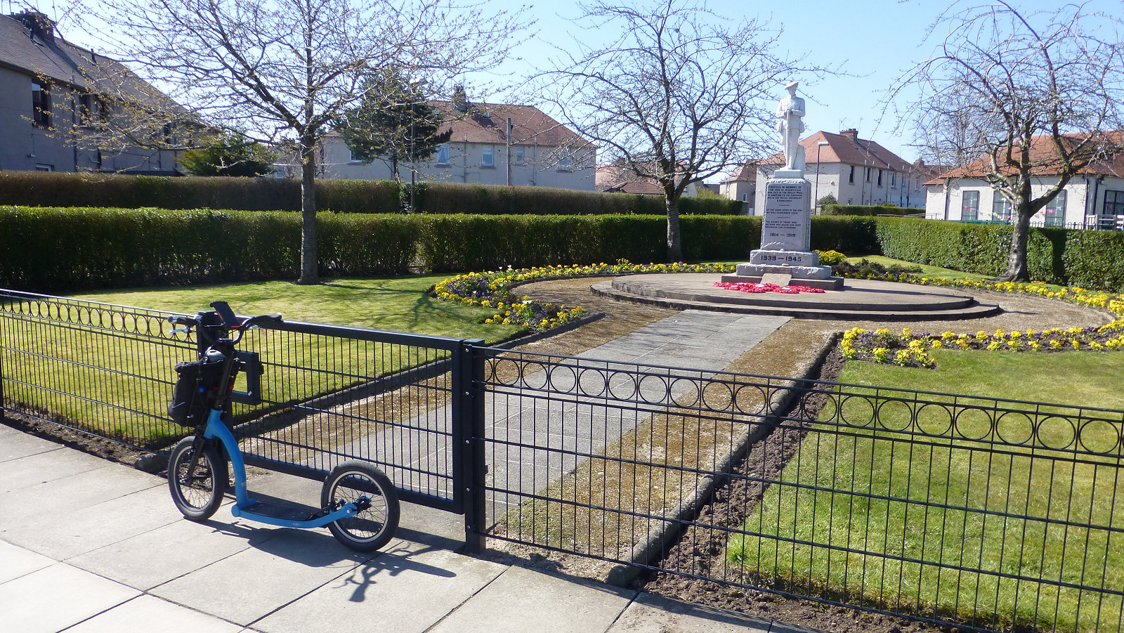
Turf zone – GeorgeWarMem
The next zone on our itinerary is DobbysSock, and its actually on the other side of the hill you see to the north-west from zone GeorgeWarMem. The hill is called Dobie’s Knowe and the sock part is a reference to Harry Potter. The track here is rough dirt and can be muddy at times. For our next zone Wee, continue onwards past DobbysSock, turn sharp left and follow the road to the B702 road to Lasswade, then go left. After a short distance you drop down a hidden lane called the Wee Brae, though the word wee does not come to mind when you are attempting to cycle all the way up from the Lasswade side. Note it can be slippery here all year round, icy in winter, and springs seeping from the embankments can keep the path surface slippery with slime all year round.
Right, you still with me? On with the tour. No rest for the wicked turfer. Our next stop is zone IKnowBroom. From the top of Wee Brae, after you’ve got your breath back having ridden your bicycle all the way up – very bad form if you push your bike – head right along the main road a short way, then left into Broomieknowe Gardens, right at the T-junction and then left. Zone IKnowBroom is in the small park to the right, just before the golf course parking area.
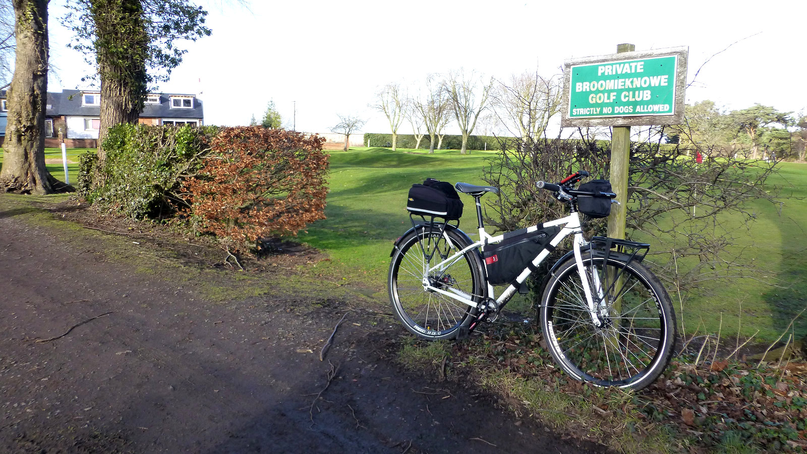
Turf zone – BroomieGolf
Our next zone, BroomieGolf, is another one of my suggestions and I apologise for this one, I knew the track was rough but if I can ride it on my Swifty Air kick scooter, you can ride it on a bike. Always nice to have something different to boring smooth tarmac all the time. To reach BroomieGolf from IKnowBroom, you would normally continue through the park and turn left, then when the tarmac runs out, go left again along the dirt track. However, you can save 100m of travel by nipping through the golf course. Now, obviously not during play and you would, of course, walk your bike rather than ride it. Very naughty if you do, at night, when no-one is around. At the parking area, there’s an entrance to the course, go right and you come out on the dirt track. But I didn’t tell you that.
The next zone is TongueSpatula, located at the health centre, so unfortunately we need to backtrack which is always something to avoid if possible. Next, LothianSquare, just an easy whizz down the cycleway then up a short ramp just before the bridge under the road. Zone LothianSquare is just across the road. Note here that the concrete slabs are often slippery when wet. The next zone on the list is NotFencedIn, just a minutes away along Waverly Crescent and Waverly Park. It’s a small grass and planted area surrounded by houses.
Turf zone – Wee
Sticking with the Waverly theme, our next two zones are WaverleyPath and WaverleyPark. I used to go the long way round to both of these zones until I noticed an almost hidden wee path to the east of the zone, brings you out in Waverly Park. The zone WaverleyPark is across the park beyond the swings and the other zone, WaverleyPath, is a short ride up the cycle path.
We are almost finished our turf tour of Bonnyrigg now, just three more zones to take. An easy whizz back down the cycleway will give us Wishart, situated at a small underpass under the railway line, then continue in the same direction and turn right for Midlothian Community Hospital and zone Slytherin, at the railings. Not all that sure on the why of this zone name other than the connection with a house in Harry Potter. Ah, I think I’ve worked it out. In Harry Potter world, the snake is the Slytherin House emblem. In the real world, the snake symbol is also used. Mystery solved. Sneaky, but clever people these zone makers. And finally, our last zone on out turf tour of Bonnyrigg, zone WayOfBaird. Time for a well-earned coffee!
* LBJ’s – Little Brown Jobs. A birding term for birds you cannot identify.
Copyright ©2021 Gary Buckham. All rights reserved.